
BLOG: Floods in India
- Floods are caused by water overflowing onto land, frequently destroying the area and its inhabitants. In other instances, the destruction rate is significantly higher when the water remains stagnant.
- After wildfires, floods are the natural calamity with the greatest global impact.
- Out of a geographical region of 3290 lakh hectares that is susceptible to flooding, more than 40 million hectares in India have been affected by floods regularly.
- According to government statistics, between 1953 and 2011, floods in India claimed the lives of 1,653 persons per year on average. India experienced 278 floods between 1980 and 2017, which impacted close to 750 million people.
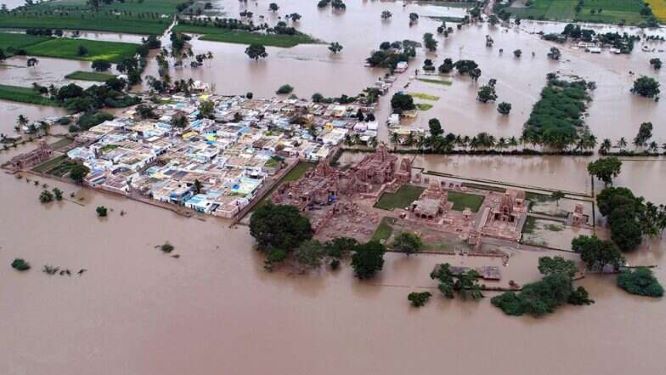
- Due to cloudbursts and uncontrolled urbanization, urban flooding is becoming a major threat.
Causes of Floods:
Weather-related factors:
- Strong Rainfall – Increasing Sea Levels
- A cloud burst is a sudden, intense downpour that causes water supplies to overflow.
- Cyclones
- Sea level rise and snowmelt due to global warming
- Landslides and earthquakes
tangible Factors:
- Dams with insufficient catchment areas
- inadequate drain capacity and poor upkeep of the drainage system.
- streams being encroached on without consideration
- of topography, particularly a steep incline.
- bare patches of vegetation.
human factor:
- incorrect agricultural methods.
- The process of infiltration is impacted by deforestation.
- flooding plain occupation preventing flows.
- Water regimes are altered by mining and other enterprises.
Types of floods:
- Riverine Floods
- These floods, also known as river floods, happen when rain, tides, and melting generate a steady water increase that eventually leads to an excessive amount of runoff from the river.
- Pluvial Floods
- Pluvial floods also referred to as flash floods, are brought on by prolonged periods of heavy rain, which raises the water level and allows it to reach the highways, where it causes flooding.
- In dryland places where water typically spills rather than seeps into the earth, they typically occur.
- Coastal Floods
- Simply put, coastal floods happen when the coast is inundated by rain, waves, or tides.
- They are also known as storm surges, and they happen when a strong storm wind forces the water to rise, usually during tropical cyclones and tsunamis.
Impacts of Floods:
- loss of life and property damage
- diseases’ rapid spread
- lack of access to critical goods, including medicines and water.
- Drownings, injuries from evacuations, such as lacerations or punctures
- loss of livestock and agriculture
- Behavioural health issues
- disruption of the communications and transportation networks.
Flood-prone regions in India:

- Brahmaputra Basin: Due to the excess water present in the Brahmaputra and Barak basins, the river banks of the two rivers overflow. Northeastern states like West Bengal, Assam, and Sikkim are frequently inundated by these rivers and their tributaries. Northern West Bengal’s Jaldakha, Teesta, and Torsa rivers, as well as those in Manipur, frequently exceed their banks.
- Ganga Basin: The northern portion of the Ganga Basin receives the highest flooding from its northern tributaries. West Bengal, Bihar, and Uttar Pradesh are the states in the Ganga basin that are most severely impacted. Rivers including the Sarada, Rapti, Gandak, and Ghagra, in addition to the Ganga, produce flooding in the eastern section of Uttar Pradesh. The Yamuna is renowned for inundating Delhi and Haryana. Every year, Bihar sees extremely dangerous floods. Along with numerous other small rivers, the rivers Burhi, Bagmati, Gandak, and Kamla contribute to that. Because of tidal influences and a lack of river routes, West Bengal suffers from floods caused by rivers including the Mahananda, Bhagirathi, Damodar, and Ajay.
- The North-west River Region consists of the River Indus and its tributaries – Sutlej, Beas, Ravi, Chenab and Jhelum. This region covers the states of Jammu and Kashmir, Punjab and parts of Himachal Pradesh, Haryana and Rajasthan.
- Mahanadi, Baitarni, and Brahmani’s overflowing riverbanks in Orissa wreak devastation. These three rivers combine to form a delta, which is densely populated. Even a few of Kerala’s minor rivers and mud streams from adjacent hills contribute to the devastation. Due to a lot of rain, floods in southern and central India are brought on by the Narmada, Godavari, Tapi, Krishna, and Mahanadi rivers. Periodically, coastal areas of Andhra Pradesh, Orissa, and Tamil Nadu are inundated by cyclonic storms in the deltaic regions of the Godavari, Mahanadi, and Krishna.
Steps taken by GoI for Preparedness and Mitigation of the floods:
Since flood control is a state concern, the state bears the main obligation. The following enactments are followed by the government:
- The National Disaster Management Authority, which has been tasked with handling all types of catastrophes including floods, was established by the center and the National Disaster Management Act, 2005, was enacted.
- The National Executive Committee (NEC), which was established by the NDMA, in 2005, and is responsibility for carrying out the plans and policies of NDMA, is chaired by the Secretary of GOI of the ministry or department.
- State governments have also established State Disaster Management Authorities (SDMA), which serve the same purposes as the NDMA at the federal level.
- Under the auspices of the Ministry of Environment and Forest (MoEF), the Integrated Coastal Zone Management Project (ICZMP) has been established to aid the Government of India in strengthening national capacity for the adoption of a comprehensive coastal management strategy across the nation.
- Since 1980, the National Flood Commission (Rashtriya Barh Ayog) to research India’s flood-control strategies, the Ministry of Agriculture and Irrigation established the institute in 1976. The R. Rangachari Committee was established in 2003 to examine how the Rashtriya Barh Ayog’s directives were carried out.
- Guidelines for the security of storage dams and other water-related structures were published in the National Water Policy of 2012.
- National Project to Reduce Cyclone Risk: The overarching goal is to reduce cyclone susceptibility and increase disaster preparedness in the cyclone-prone States and Union Territories of India, while also preserving the coastal ecosystem.
- To help with flood forecasting, the Central Water Commission (CWC) keeps track of river discharge measurements and water levels in dams.
Due to the frequency of floods, better evacuation procedures, region-specific regulations for flood-prone areas, safer housing and infrastructure, and post-disaster emergency response teams could all help save more lives.


